About UCMP : UCMP newsletter
UCMP's 2017 Basin & Range field trip, page 1
by Dave Smith, with contributions from Seth Finnegan; all photos by Dave Smith unless otherwise indicated
Why have field trips? Department of Integrative Biology professor and UCMP curator Seth Finnegan summed it up nicely when he said, prior to leading his first UCMP field trip in 2014, "My intent is to provide graduate students who may not have spent much time in the field an opportunity to see fossils in their stratigraphic context, to learn some of the basics of using sedimentology and taphonomy to make paleoecological inferences, and to consider the ways in which paleontological information is filtered through the geological record." Seth has since co-led three more field trips — now annual events — and his motivation has remained the same.
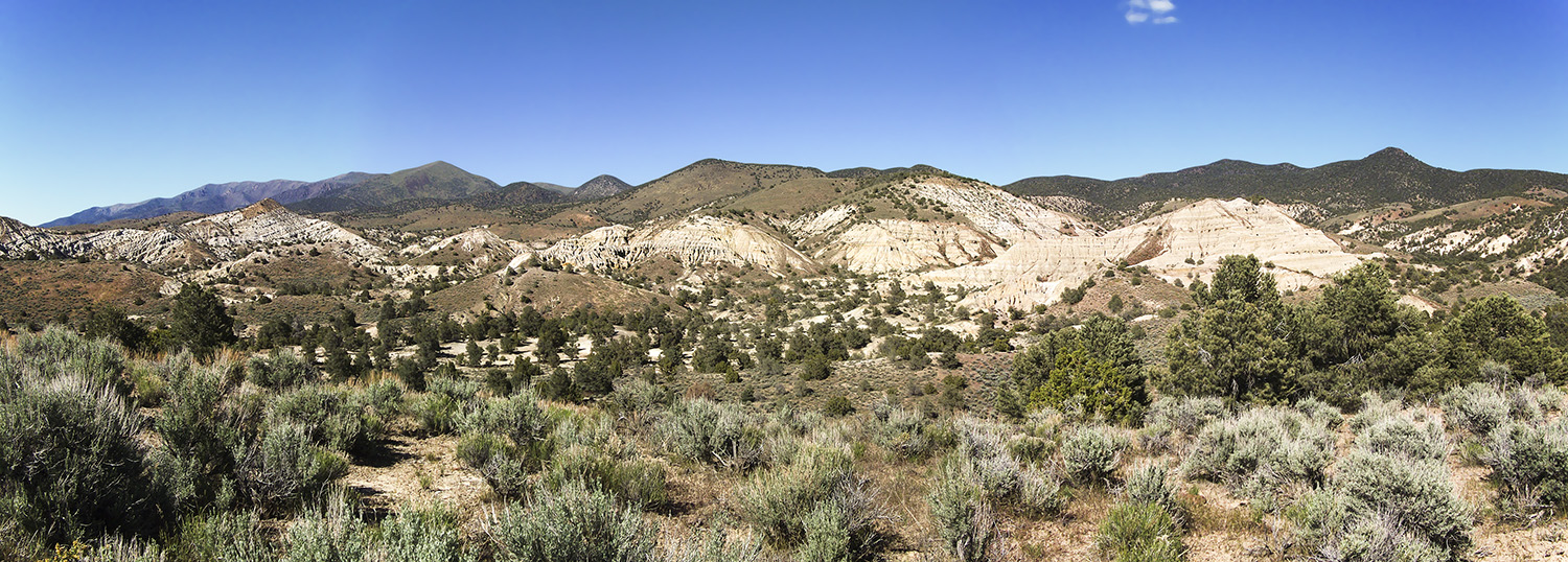
This year's field trip took us somewhere entirely new: across Nevada and into western Utah to explore the Basin & Range along the highway 50 corridor. Although I retired from the museum two years ago, I tagged along on this one to once again keep a record of the trip in both words and photos; I had done this for two previous field trips to southern California: 2014 Kettleman Hills & Death Valley and 2015 Monterey Formation & Anza-Borrego Desert State Park. I missed out on the 2016 trip that revisited the Kettleman Hills and Death Valley.
Up until this year, the field trips had been scheduled for the week of Spring Break (March) but this one began at the end of the Spring Semester, the day after the Department of Integrative Biology's graduation ceremony; we left Berkeley on Sunday, May 21, and returned on Saturday, May 27. Leading the trip were Seth and fellow UCMP curators and professors of Integrative Biology Cindy Looy (co-leading for the third consecutive year) and Ivo Duijnstee (his second year as a co-leader). There was a smaller number of participating students this year — just seven: Peter Kloess (Padian Lab), Daniel Latorre (Marshall Lab), Jun Ying Lim (Marshall Lab), Mackenzie Kirchner-Smith (Padian Lab), Emily Orzechowski (Finnegan Lab), Franziska Franeck (Liow Lab, University of Oslo), and Richard Stockey (Sperling Lab, Stanford University). Jun and Emily were the only veterans of previous field trips (Jun, two, and Emily, four).
 Click on any photo in this story (with one exception) to see an enlargement.
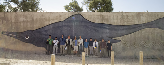
 Our group in front of William Gordon Huff's ichthyosaur relief at Berlin-Ichthyosaur State Park. From left are Jun Ying Lim, Daniel Latorre, Seth Finnegan, Ivo Duijnstee, Peter Kloess, David Smith, Franzi Franeck, Mackenzie Kirchner-Smith, Cindy Looy, Richard Stockey and Emily Orzechowski. Photo courtesy of Jun Ying Lim.
Our vehicles — four four-wheel-drive SUVs rented through the Enterprise near campus — and groceries — enough to last us through Ely, Nevada — were picked up on Saturday, the day before our departure. The plan was to meet at the West Circle near the Valley Life Sciences Buiiding at 11:00 Sunday morning.
Sunday, May 21
I was the first to arrive, followed shortly by Franzi. We didn't have to wait long before Seth and Ivo drove up in two of the vehicles. I jumped into Ivo's vehicle and we drove back to his and Cindy's place to pick up another SUV that had been left there. While doing that, the rest of the trip participants, as well as Peter with the fourth SUV, arrived at the Circle. It took a while to load all the supplies, everyone's gear, water containers and coolers; we didn't leave campus until almost 12:30 PM. Joining Seth in a white Chevy Tahoe were Daniel and Jun. Peter drove a blue GMC Yukon, and was accompanied by Emily and Franzi. Ivo, Cindy and Mackenzie were in a black Ford Expedition; Ivo and Mackenzie would switch off as drivers. I drove a white Expedition with Richard as my sole passenger. As in the past, each car had a walkie-talkie and, once again, they proved to be very useful, both in pointing out geological features along our route and in general communication between the vehicles.
We headed east on I-80 and made one stop in Roseville for lunch, to fill our tanks, and to get more ice for the coolers before hitting the road again.
Our four SUVs rendezvoused in Fernley, NV, where we followed Seth to the offices of EP Minerals, the mining company on whose land we'd be working the next day; here, Seth dropped off liability waivers for everyone in the crew. Then it was off to the Lake Lahontan State Recreation Area where we'd be camping this first night. On our way there, Seth used the walkie-talkie to let us know that shoreline terraces from Pleistocene Lake Lahontan were visible on the surrounding hills.
At its peak, around 12,700 years ago, Lake Lahontan covered much of western Nevada, extending north into Oregon and west into northeastern California. The only true remnant lakes of Pleistocene Lake Lahontan are Pyramid and Walker Lakes. Modern-day Lake Lahontan is not a true remnant of the ancient lake, but a dammed reservoir, fed by the Carson and Truckee Rivers. Pleistocene Lake Lahontan once covered what is now the Black Rock Desert, where Burning Man is held, to a depth of about 500 feet. Due to climate change resulting in increased evaporation, most of the lake had dried up by 9,000 years ago.
In the Recreation Area, we drove to Silver Springs Beach and set up our tents on a sandy area well above the water's edge (we'd seen posted signs saying that the lake was rising three to six inches a day because of snowmelt). Jun and Daniel prepared a nice dinner of burgers and corn on the cob. They cooked up all the leftover ground beef and saved it for the next night's dinner.
Small, black flies tormented us upon arrival at the campsite, but once the sun went down and the temperature cooled, the flies disappeared. We sat out for a while to do some stargazing before heading to our tents. I heard coyotes howling shortly after writing my journal entry and then owls periodically throughout the night.
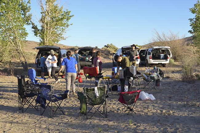
Setting up camp and preparing dinner at Lake Lahontan State Recreation Area.
Monday, May 22
It was light by 5:30 so I began to pack up my things. I could see from their shadows on my tent that the black flies were already active. Seth got up around 6:30 or so to make coffee. We would have had breakfast there, but the flies were so horrible — getting into people's eyes, ears, noses, and mouths — that as soon as the coffee was consumed, we packed up the SUVs and got out of there.
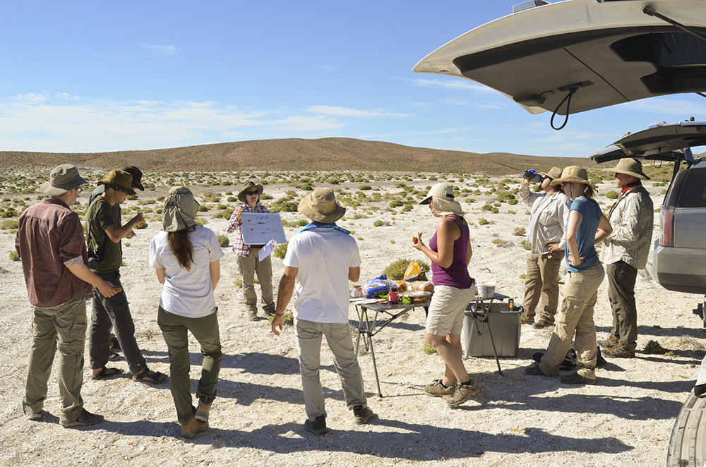
Our first destination of the day was a diatomite mine east of Fernley and south of Hazen. I thought that the dirt roads leading to the mine were rocky and fairly treacherous, but they turned out to be fairly smooth compared to some of the roads we'd navigate later. Once at the mine, we set up the handy camp table that Cindy and Ivo had brought along and laid out bagels and cream cheese for breakfast. While eating, Seth and Cindy talked about the stickleback fish fossils that are found at this site and how their evolution can be observed over time.
Long before Lake Lahontan — about ten million years ago during the Miocene, when precipitation was higher than it is today — a deep lake covered this part of Nevada. Diatoms — microscopic, planktonic organisms with siliceous tests — thrived in the lake's waters. When the diatoms died, their tests sank to the bottom of the lake where, over time, thinly laminated, white, chalky layers accumulated, creating a thick deposit of what we call diatomite. Diatomite — diatomaceous earth — is used primarily for filtering liquids, as an additive in such things as paint and plastics, and as an absorbent. Also living in the lake were stickleback fish, whose fossils are abundant within the diatomite layers. Originally, the sticklebacks in the lake had a reduced pelvis and no spines. After about 10.000 years there was a rapid change in the population to a form with both a complete pelvis and spines; this is probably due to a merging with another lake where the complete-pelvis and spine-bearing sticklebacks were common. But in another 10,000 years, the population re-evolved into the reduced pelvis and spineless form; this transition can be seen in the fossil record.
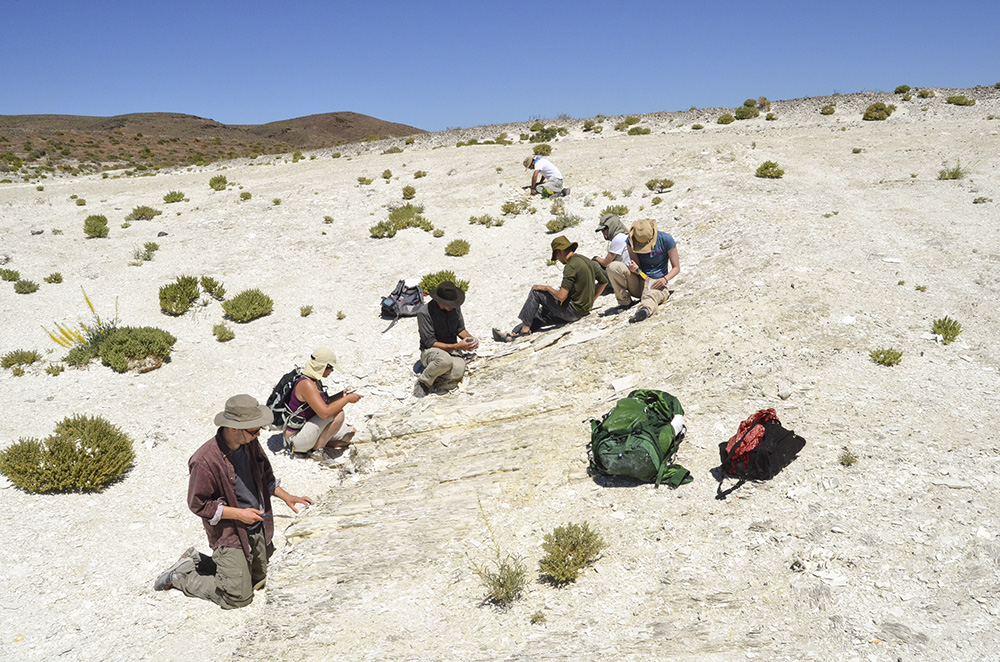
We hiked over a low ridge and into a depression where the layers of diatomite were exposed and spent the next few hours splitting open the layers looking for stickleback fossils. The layers were so thin that putty knives were distributed to split them. Seth found some particularly good specimens.
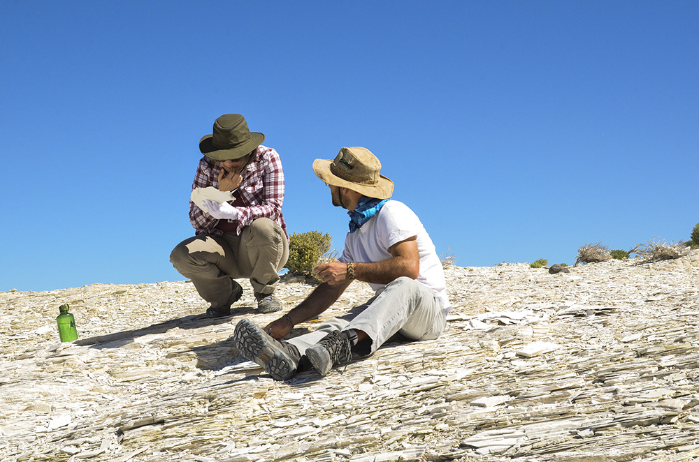
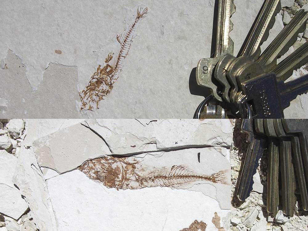
Top left: Cindy gives us an introduction to stickleback fish evolution while we finish our lunch out at the diatomite quarry. Top right: Cindy ponders a fossil that Daniel has found. Note the thinness of the individual diatomite layers. Bottom left: Some very nice stickleback fossils were found at this particular exposure. Bottom right: Two nice stickleback specimens with keys for scale.
Following lunch at the cars, we left the mine, headed back up to 50, and then east towards Fallon. There we gassed up, got more ice, and filled our water containers. About 20 miles east of Fallon, Seth directed our attention to an enormous sand dune — at Sand Mountain Recreation Area — to the north of the road. The prevailing winds had built a two-mile long, 600-foot high dune out of sands deposited in Pleistocene Lake Lahontan.
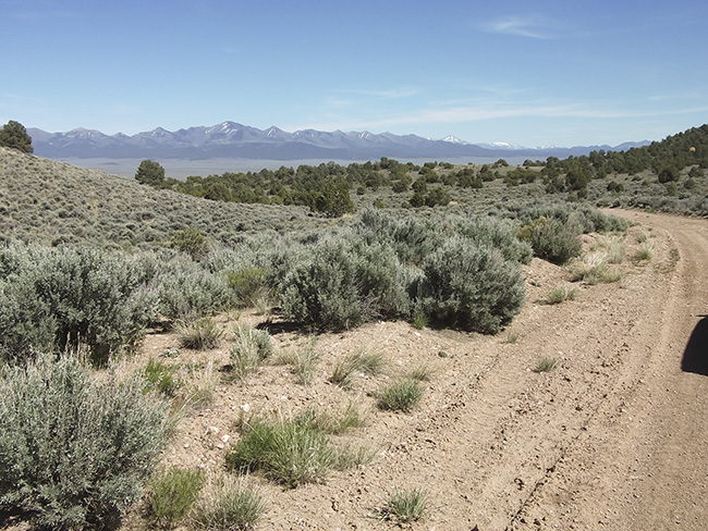
After another 30 miles or so, we left 50 and headed southeast on dirt roads towards Buffalo Canyon, where the famous Buffalo Canyon Flora was collected by UCMP alum Daniel Axelrod years ago.1 The roads here were really bad — very rocky and heavily eroded — I was amazed that we continued to forge ahead, but somehow, all four of our vehicles made it through. We stopped at a great place to make camp, up on a ridge with wonderful views of layered exposures to the north and east.

Exposures on the east side of Buffalo Canyon, as seen from our camping area.
I helped Mackenzie make a dinner of chili with bread and grated cheese. A campfire was made using dead sagebrush and juniper wood. We watched the sun set and the stars come out. Most everyone was in their tent by 10:30.
Tuesday, May 23
The day dawned clear — looked like we were in for another beautiful, but warm, day. After a breakfast of coffee, bagels and muffins, everyone packed up their gear. Then it was time to find those plant fossils.
Based on the dating of ash layers, the Buffalo Canyon Flora is considered to be about 15 million years old (middle Miocene). At that time, a large freshwater lake existed in this area, surrounded by lush vegetation. Today, the area gets about 15 inches of annual rainfall and most of that is snow; the dominant plant life includes pinyon pine, juniper and sagebrush. Axelrod, in comparing the fossil flora to modern analogs, believed that in the middle Miocene the area was receiving year-round rain, about 35 to 40 inches annually. He also determined that summer temperatures were cooler and winter temperatures were warmer than they are today. Fifteen million years ago the flora was a mixed conifer-deciduous forest with plants such as cattails and water lilies growing along the lakeshore. Axelrod identified over 50 different plant species in the diatomites, shales, and mudstones of the Buffalo Canyon Formation.
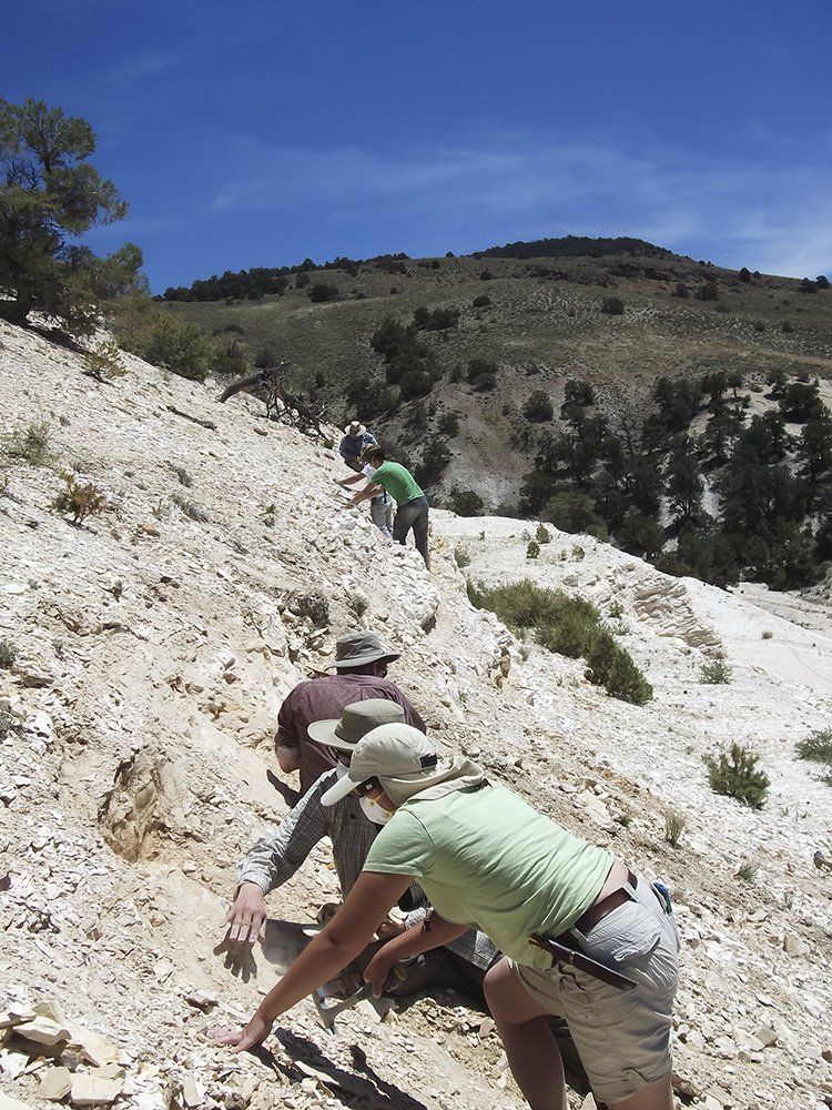
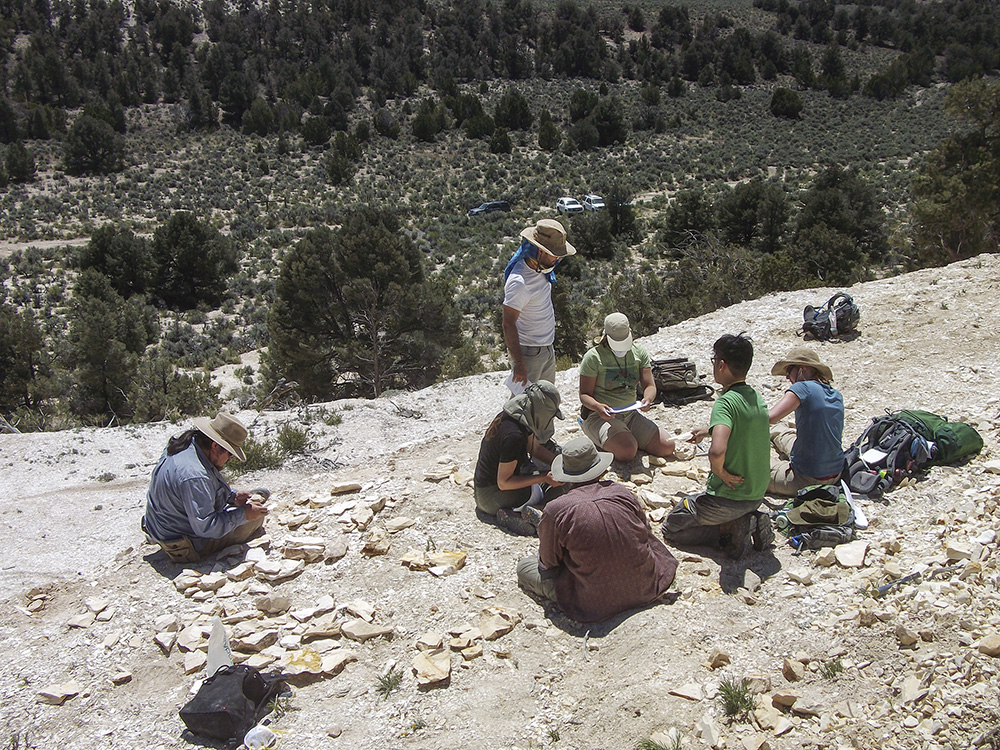
Neither Seth, Cindy nor Ivo had been to the Buffalo Canyon site before, so they were depending on directions given to them by UCMP's Senior Museum Scientist in charge of the paleobotanical collections, Diane Erwin, who had been to Buffalo Canyon before. Diane identified the location of a good collecting area on Google Earth prior to our leaving Berkeley. We drove to the spot and began poking around on the hillside. We did find occasional leaves and seeds, as well as a few fish fossils, but Seth and Ivo were not convinced that we were in the best place. So they took one of the vehicles and disappeared for a while. They returned to report that they'd found a good layer at one end of a substantial quarry not too far away. After lunch we piled into the vehicles and followed Seth over some very dangerously eroded dirt tracks to the new spot. Seth pointed out the layer where we should look so the group spread out along an upper terrace of the quarry.
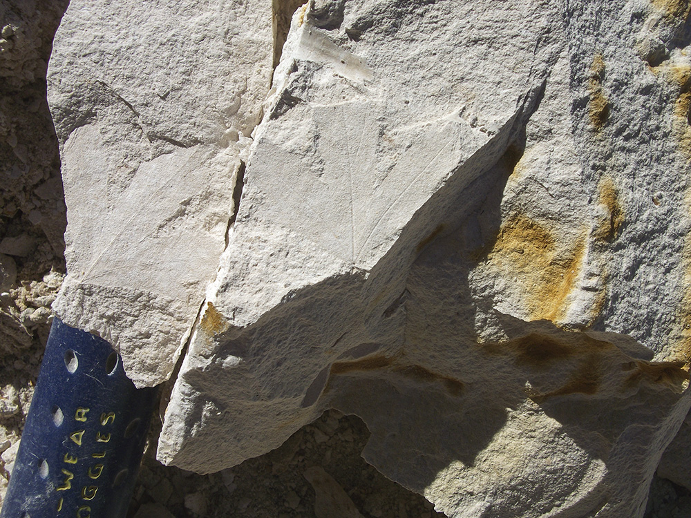
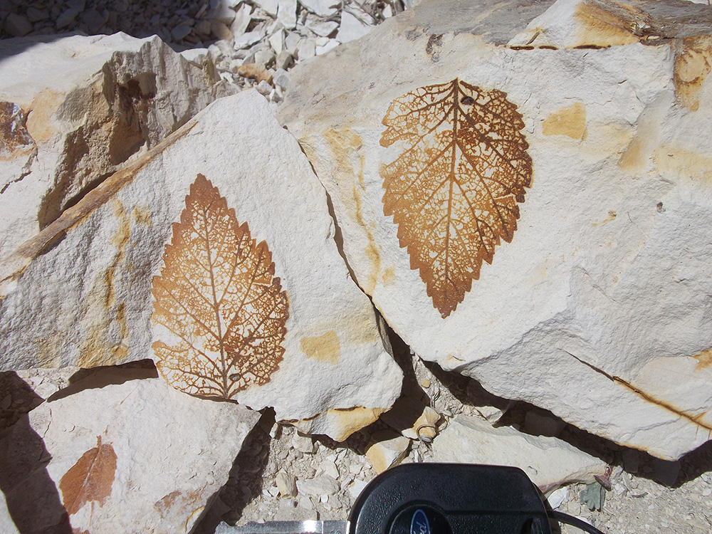
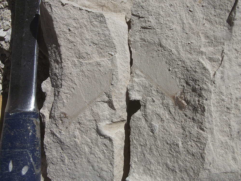
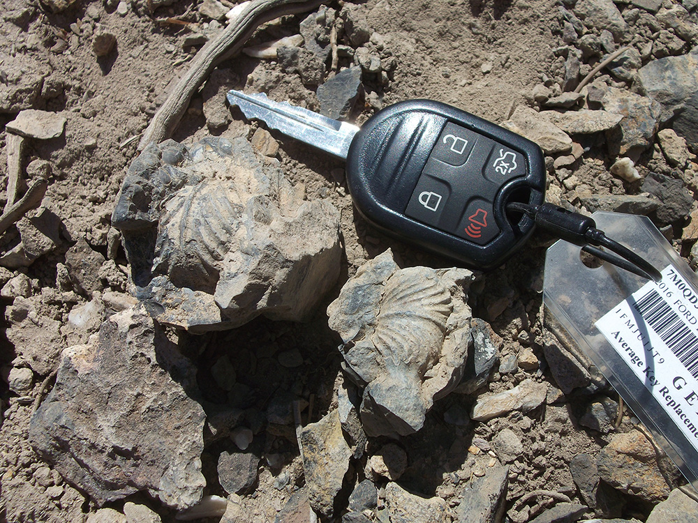
The leaves and seeds that we were finding were preserved as carbonized impressions in the diatomite. Sometimes the carbon would be leached away, leaving just the impression in the fine-grained rock. We found a great variety of leaves — primarily oak, elm, birch, sycamore, cattail, willow, as well as two water lilies and some winged seeds. After amassing a good number of specimens, the students were given an exercise in which they were to separate the leaf fossils by size and margin type; with these numbers, they were able to roughly calculate the mean annual temperature and precipitation at this location 15 million years ago. Despite having far fewer specimens than Axelrod (he collected some 6,000), the student's numbers were not that much different from those of the paleobotanist.
Top left: Splitting open a chunk of diatomite revealed this three-lobed leaf. Rock hammer provides some scale. Middle: The group spread out along this level in the quarry to look for leaf fossils. Top right: A winged seed from another split chunk of diatomite. Bottom left: A nice carbonized impression of a leaf with a serrated margin. Car key for scale. Bottom right: Surrounded by the leaf fossils they collected, (from left) Peter, Emily, Daniel, Richard, Mackenzie, Jun, and Franzi calculate the mean annual temperature and precipitation for this area 15 million years ago.
Around 3:00 we left Buffalo Canyon and began the drive to Berlin-Ichthyosaur State Park. We followed a dirt track south down the canyon and over the pass at Buffalo Summit; at the top we caught a nice view of the Shoshone Mountains to the southeast, still with some snow on them in places. After coming down from the mountains (the Desatoyas), the road straightened out and ran southeast for about 15 miles across Smith Creek Valley. Along this route we saw a couple pronghorn, one being spotted just before reaching the ghost town of Berlin.
Looking southeast from Buffalo Summit towards the still somewhat snow-covered Shoshone Mountains.
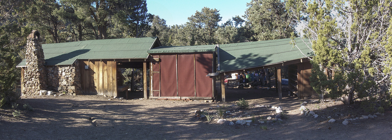
After a brief stop at the Berlin visitor center, a tiny wooden structure with nobody home, we continued on towards the campground. To our delight, we found signs saying that the entire campground was reserved for our group! At 4:45 we pulled up and parked right near the cabin that UCMP's Charles Camp had built as his "home" back in the mid-1950s when he was spending long periods of time working at the ichthyosaur quarries.
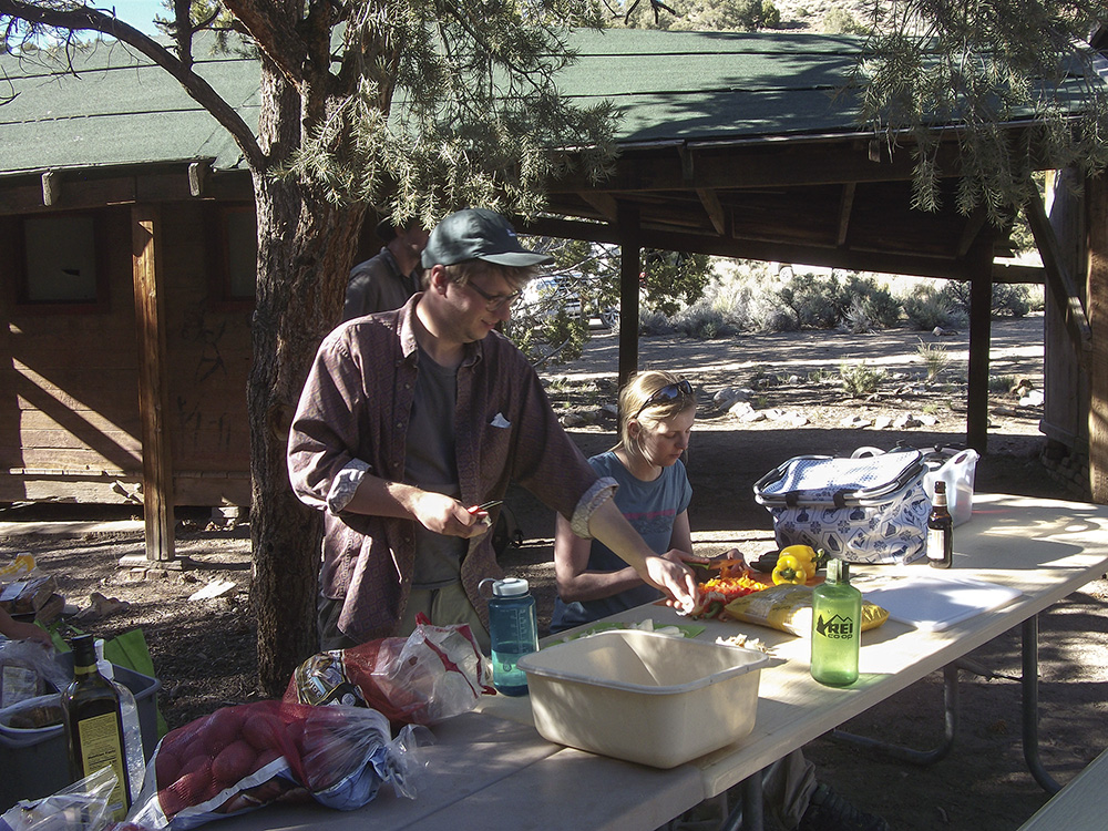
We got out the coolers, food tubs, stoves, and cooking gear and Richard and Franzi started right in on preparing dinner, a tasty vegetable-rich curry. Around this time, Anthony, a park staffer, stopped by to make sure everything was okay and to remind us about our tour of the quarry scheduled for tomorrow. Seth asked if it would be possible to have our tour early in the morning and Anthony agreed to look into it. He returned a short time later saying that we could have our tour at 9:00. Daniel and Jun got some charcoal burning in the fire pit using toilet paper soaked in olive oil — worked like a charm. They grilled up some linguica sausage and corn on the cob to augment the curry. We dined at two picnic tables that we placed end to end.
I had been to the park a couple of times before, but had never checked out Camp's cabin. In late 2014 I did a lot of research for the 2015 UCMP wall calendar entitled UCMP and the development of the ichthyosaur quarry at Berlin-Ichthyosaur State Park. I'd read all of Camp's field notes relating to this site and the building of the cabin so I found it very cool to be dining just a few feet from the cabin itself. I had brought a copy of the 2015 calendar with me to present to the park staff. Because of my knowledge of the site, Seth had me give our group a short talk about the park's history.
Left: Richard and Franzi begin dinner preparations beside Charles Camp's cabin. Right: The cabin that Charles Camp built at Berlin-Ichtyosaur State Park. Some of our group can be seen through the breezeway at the right.
After dinner we hung out at the picnic tables and kept the fire going with pine cones and some dead wood. Since we had the whole campground to ourselves, we were able to spread out our tents and get some privacy.
Wednesday, May 24
I got up as soon as it was light. I dressed and packed up all my gear, trying not to make too much noise. I took a walk along a path on the north side of the canyon; I didn't know it at the time, but I walked right by one of Camp's ichthyosaur quarries. When I got back to camp, Cindy and Ivo were busy preparing breakfast. Ivo fried up some potatoes to go with the usual breakfast fare. After the morning repast, we packed up the cars so that we'd be ready to go following our tour.
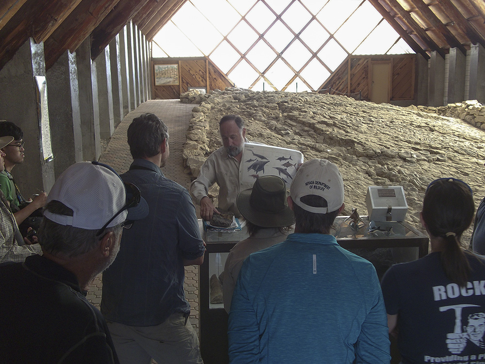
Just before 9:00 we hiked up the hill to the visitor center and were greeted by Mike, a retiree who'd be giving us the tour. A couple in an RV from the Sparks area tagged along with our group. Mike opened with some background info on ichthyosaurs and then told us about the bones exposed in the quarry before us.
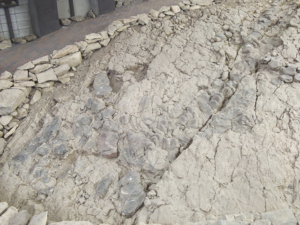
The quarry protected by the A-frame shelter contains the partial skeletons of at least seven individuals of Shonisaurus popularis, Nevada's State Fossil. The bones had a faint bluish cast to them making them easier to distinguish from the brown matrix. These ichthyosaurs swam in an inland sea about 220 million years ago. Camp could not account for why so many individuals ended up so close together. He theorized that the animals may have beached themselves and died, but current thinking is that the ichthyosaurs died in deep water, possibly from a toxic algal bloom. At the time of its discovery, these ichthyosaurs were the largest known, however, another species of Shonisaurus has since been found in Canada that is even larger (69 vs. 49 feet long). Almost 40 specimens — none of them complete — have been found in and around the park. Originally thought to have a dorsal fin like later ichthyosaurs, current reconstructions of Shonisaurus drop the fin because of its close affinity to the fin-less Shastasaurus.
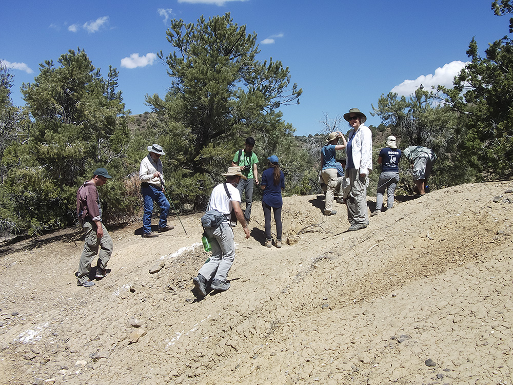
After the tour, I gave Mike a copy of the UCMP Berlin-Ichthyosaur wall calendar and he said that he'd pass it along to his supervisor … after he'd read it. Mike told us about a couple other quarries that Camp had worked in; one was across the road from the campground (I had already visited it during my early morning walk). The other was back down the road a ways to the west, then south along a gully and up a ridge. The latter was a sizable quarry; Mike said that a National Geographic crew had done some excavating there recently. We found many bone fragments, as well as ammonites.
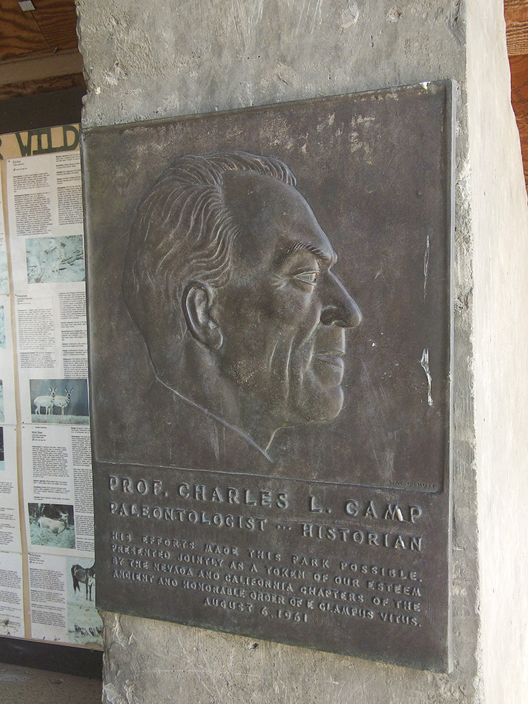
Top left: Our tour guide, Mike, provides us with some background on Shonisaurus popularis at the Park's visitor center. Bottom left: One of the more complete specimens of Shonisaurus displayed in situ at the visitor center. The vertebrae of the tail can be seen running to the upper right; the head is at the lower left. Note that the bones have a slight bluish cast to them. Center: A bronze plaque honoring Charles Camp is mounted on a post just inside the entrance to the visitor center. The plaque was made by sculptor William Gordon Huff. Top right: Tour guide Mike (second from left) took us to another of Charles Camp's ichthyosaur quarries west of the visitor center. Bottom right: Ammonite fossils were found along with several chunks of ichthyosaur bone at the quarry Mike showed us.
Here we thanked Mike for the informative tour, got back in our vehicles and left the park. We drove north on the dirt County Road 21, crossing over the Shoshones at Ione, then north again through the Reese River Valley towards 50. We finally hit pavement when we turned onto State Route 722. Seven miles later we hit 50 and headed east into Austin. In Austin we pulled into a Chevron market to get beverages and/or munchies.
Peter reported that he was getting a low-tire-pressure warning for his left rear tire. A screw was found embedded in the tire, so Peter moved the vehicle to a flat surface. We pulled out the owner's manual and jack and figured out how to get the spare out from underneath the vehicle. Seth jacked up the Yukon, removed the bad tire and put on the temporary spare. The whole process took only a half hour. Then it was back on the road.
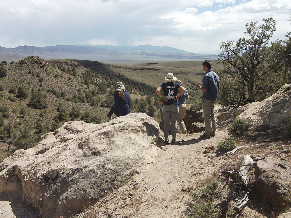
We stopped at the Hickison Petroglyph Recreation Area just past Hickison Summit for lunch. It was sunny, but very breezy and large thunderheads were visible off to the south and east. After eating we followed a trail to the petroglyphs. They weren't too impressive, but then some had been damaged by vandals. We continued up the trail to get some great views. We saw many lizards, a snake, and a raven's nest on a cliff face.
Back in the cars, we continued east towards Ely and didn't bother to stop in Eureka. About 35 miles west of Ely, Richard and I began getting a low-tire-pressure warning. I reported this to Seth when we stopped at an exposure of the Carboniferous Ely Limestone just northeast of Illapah Creek Reservoir. The alternating thick and thin, gray limestones of the Ely exhibit cycles of marine sedimentation as sea levels changed during a period of worldwide climatic fluctuations. As one moves up in the sequence, the fossils change as you go from offshore to foreshore deposits and back again, providing a nice opportunity to examine how different groups track their favored environments. The fossils we observed included brachiopods, crinoids, rugose corals, bryozoans, and bivalves. Gastropods, crinoids, echinoid spines, and forams are also present in the Ely Limestone.
Our vehicle made it to Ely without any trouble. On the way there, we did have some short periods of rain but managed to dodge the more serious-looking thunderstorms. Seth had hoped that we could get Peter's tire patched today, but we arrived too late (around 4:30) to have it dealt with; Peter took the Yukon to the tire shop — they said to come back in the morning at 8:00. While Peter was on his errand, the rest of us headed to the front desk of the Hotel Nevada and Gambling Hall, passing through its smoky casino on the way. Cindy checked us all in and distributed the card keys. After moving our gear into our rooms and cleaning ourselves up a bit (it had been over three days since our last shower), we returned to the lobby to rendezvous with the others. Our original plan had been to dine in the hotel's restaurant, but it had been replaced by a Denny's, so Cindy went online to look for better options. She found a place called the All Aboard Cafe & Inn where she was told that they had a table for all 11 of us. We drove over in three of the SUVs and were pleasantly surprised to find that we'd have a room of our own. The Inn had an excellent menu; dinners ordered included fried chicken, a ribeye steak, spaghetti and meatballs, and burgers. To our amazement, the waitress was happy to give us all separate checks. Back at the hotel, most everyone went to their rooms, but some, like Peter, went out again.
Left: Dealing with the first of several problems we'd have with our tires. Here we're changing a tire on Peter's Yukon in an Austin gas station lot. Center: Enjoying the view at Hickison Petroglyph Recreation Area are (from left) Emily, Jun (in green shirt), Mackenzie, Franzi, and Seth. Note the storm over the mountains to the south. Right: The Hotel Nevada in Ely where we spent one night.